

 HD Aerial Videography & Photography
GREAT DRONE VIDEOS.ca specializes in low altitude, high definition aerial imaging services, including aerial videography and aerial photography.
We offer a cost effective alternative to manned aircraft for a variety of applications in the fields of Brand Marketing, Engineering, Construction, Aggregates and Mining, Environmental Planning & Monitoring, Agriculture, Forestry, Archeology and something we call 'Memories' (see below for definitions). We also provide expert video, special FX, motion graphics and photo retouching services.
Note: Our Pilot is UAV Certified by a Transport Canada recognized training facility and we are fully insured. Both of which are requirements by Transport Canada for safe Commercial Operations.
'docs' (Transport Canada requirements: these are safety documents & bulletins provided to all internal GreatDroneVideos.ca Team Members prior to every operation / mission to ensure we all FLY RIGHT!)
The sky is no longer the limit! GREAT DRONE VIDEOS™ soars beyond our horizontal lives - from the International award-winning company inspirtainment inc™.
Creating stunning aerial imagery takes much more than the latest drone technology. It takes vision, passion, experience and an eye for the extraordinary!
With over 50+ years combined experience in visual arts, from advertising, broadcast TV and photography to motion graphics and animation, when WE see the sky, we see a canvas for unlimited possibilities!
Serving Southern & Central Ontario and the beautiful Surrounding Skies!
For unique advertising, photographic and video campaigns!
Call GREAT DRONE VIDEOS (905) 342.1038 or email us today!
(a division of inspirtainment inc.)
We really do love what we're doing! See for yourself!
Check out the rest of our inspirtainment site.]
HD Aerial Videography & Photography Services:
ARCHITECTURE
AGRICULTURE
BRAND MARKETING
CINEMATOGRAPHY
CONSTRUCTION SITES
DAMAGE ASSESSMENT
ENGINEERING
EVENTS & CONCERTS
INDOOR PHOTO & VIDEO
INDUSTRIAL SITES
LAND RESOURCES OVERVIEWS
PLANNING & MONITORING
REAL ESTATE [Showcase]
STRUCTURAL INSPECTIONS
SURVEYS
...and so much more!
Think beyond your horizons. Think GREAT! We are all only limited by our imaginations. Fly!
inspirtainment inc™ was created to inspire and entertain.
TURNING IDEAS INTO REALITY©
We are award-winning visual communicators working with companies, individuals and entrepreneurs of all sizes. We create original logos, branding, video and broadcasting for your products and services. Everything digital to ink! AND WE FLY!
OCCUPASSION©, occupä'ssion
(n.) the harmonious synthesis of inspiration from unrelated and unexpected influences and the work that takes up one's attention: habitual employment, craft or trade.
It's a word we created years ago. We love what we do. We really do and are constantly on the lookout for opportunities to expand our creative horizons.
We help you transform your business and your dreams with a whole new perspective.
Drones create a new visual paradigm made possible by flying high quality cameras to almost any desired vantage point. Below is a small sampling of the various aerial possibilities we offer.
Harness your memories TODAY! This is special category that's often overlooked - or not even considered - but yet very dear to everyone's hearts. As much as we don't like to admit it we all get older. Retirement homes have to be looked into, lifelong homes and beloved cottages have to be sold and forgotten, and family members and friends pass on. Our cherished memories fade. Call us to fly around (and in) that cottage wonderland you grew up with NOW. Picture your parents - years from now - waving at the camera from their favourite beachside chairs. Call us to help you harness your treasured and lasting memories TODAY!
We can help you analyze your crops to see where problems might develop.
From multi-million dollar projects to single family homes, our aerial flexibility is without a doubt the best tool for real estate agents and developers. From taking stunning general views of your properties to zooming in on important selling features, let GREAT DRONE VIDEOS transform your marketing possibilities. How about showing your potential clients the exact view they will have while driving up their driveway or from their balcony before the condo complex is built?
Drones are able to carry very high resolution cameras that deliver cinematic quality 4K files. Cameras and the drones are getting smaller making this available to more and more creative filmmakers and broadcast experts like us. If you look carefully at movies and documentaries today, it is hard to find one that has NOT made use of drones to create very dramatic effects.
Get a bird's eye overview of the progress of your various construction sites and build an archive of your progress and achievements for your marketing. Think seasonal time-lapse footage too.
Have you undergone a wide scale destructive event like a fire, earthquake, violent storm over your land, locality or company premises. We can use our drone expertise to quickly assess the damage to give your insurance company the total picture.
Create unforgettable outdoor souvenirs of important corporate, entertainment or life events like outdoor concerts, inaugurations etc.
Our drone can easily fly indoors with proficiency and surveillance with its multiple navigation systems and object detection. Get dramatic vantage points of your advertising or architectural designs.
Industrial sites that cover wide areas can easily be surveyed, photographed or filmed with drones. Volumetric assessments are also possible in mining and quarry sites.
From the air we can survey large areas for planning pre-construction of multi-housing projects or highlight the surveyor's borders from the sky. In edit we can also overlay a 2D blueprint or 3D view of forthcoming constructions. A great tool for urban development, archaeological research, golf course design or maintenance, ski slopes management, stock or volumetric inventory and so much more.
We can help you inspect hard to access places like the towers, rooftops edges, bridges, windmills, electrical installations etc.
GDV-i (GREAT DRONE VIDEOS/inspirtainment) provides documents prior to “Day-of” which outlines all pertinent UAV mission information, which is attached to call sheets that everyone involved receives prior to the UAV mission. “Day-of” operation there is a safety meeting given to all personnel involved with the production. During the days operations GDV-i might give additional safety instructions / meeting depending on location, UAV operation at the location and/or environmental changes.
Download PDF Security Plan (57KB)
The area will be closed (further referred to “Lock-off “) to all general public within 150 feet of the UAV operations at all times. The 100 feet guideline provided by Transport Canada is not sufficient for most projects due to the nature of various locations so a minimum of 150 feet is used instead.
Ensure there is NO reasonable possibility of spectator incursion as we are operating.
On-Site Survey: (Pre-Flight and Day-of)
Our security plan for the area of operation and security plan for the area to be over flown ensures no hazard is created to persons or property on the surface:
Physical and Remote Control Station security:
Note: flight within 150 feet horizontally of persons not involved in the operation of the UAV is not permitted. Flight within 100 feet horizontally of buildings and occupied vehicles or vessels will not be permitted without the owner’s consent and lack of objection from the occupants.
There is nothing in this mission within 100 feet of roads or rights of way or within 100 feet of occupied vehicles (without the occupants’ permission).
Isolation of bystanders during Take-off/Launch, In-flight and Landing/Recovery:
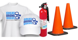
Permission to access private property:
Permission from Aerodrome Authorities:
Permission for land use from other jurisdictions:
With the above info, all permission and permits are required / provided before entering the location for UAV operations where applicable: City (Film) permits, Ports Authority, Parks and Recreation, NavCanada, Transport Canada, NOTAM and Private and/or Commercial Property owners.
General Public/Structures/Vehicles/Roadways:
NO ACCESS - depending on location and speed we generally increase the lock-off area.
Non-Essential “Production Personnel”: people involved in the overall production but not needed for the UAV operation.
Essential “Production Personnel”: people involved with the production during UAV operations
ATTACHMENTS:
Hazards Notes:
Download PDF Emergency Procedures (32KB)
The objective of this plan is to maintain the highest level of public safety by developing prevention and preparedness solutions to possible emergencies.
Note: Our secondary and passive role continues to refine processes and documentation.
When a “Special Flight Operations Certificate” has been issued by Transport Canada, GDV-i will meet all the conditions of the certificate. The restricted area is off limits to all public vehicles and general public during the UAV operations.
DGV/i understands and acknowledges that relying on calling 911 would not, meet the standard expected of an emergency contingency plan and; that calling 911 is only related to the emergency contingency plan actions and that it is not appropriate to call 911 for aircraft-related emergencies (e.g. lost link, fly-away, damage to UAV, etc.) Joint Rescue Coordination Centers are not contacted for any UAV related emergency or accidents.
Responsibilities:
Ground Supervisor:
Communications:
Major Emergencies:
Hospital:
First Aid Station:
Security:
Briefings and Meetings: All personnel are briefed on this emergency plan prior to the UAV operation. A special briefing of all emergency personnel will occur 'Day-of' - special hazards, UAV familiarization and emergency considerations.
Key Phone Numbers / Contacts:
Made available to all GDV-i personnel 'Day of' UAV operation via printed hardcopy Mission Sheets. (e.g. available emergency services, methods of contacting emergency services, checklists)
Download Rouge Checklist (21KB)
Notes:
If Rogue UAV should happen follow the below:
Give the following details:
Contact 911 with the following information:
Follow the 'Emergency Procedures' and 'Security Plan' detailed in this 'docs' section.
Download PDF Safe Operating Procedures for Aerial Filming (33KB)
The plan will incorporate the following
At the start of each day’s video shooting the Aerial Coordinator and/or Pilot in Command and the designated production representative will conduct a BRIEFING/SAFETY MEETING for the production staff and those persons necessary for filming, including emergency, safety and security personnel.
All BRIEFINGS / SAFETY MEETINGS should include the following:
No changes. A preplanned video shooting sequence will not be changed in any way without the authorization of the Aerial Coordinator and/or Pilot in Command. No changes should be made once the UAV(s) is/are airborne.
One person. The Aerial Coordinator and/or Pilot in Command should designate one person as the Ground safety contact with no other responsibilities. The Spotter may be designated as the ground safety contact around the UAV, if qualified.
If there is a question as to safety of any aerial filming sequence involving low, over the camera shots, a Briefing/Safety Meeting should be held between the Aerial Coordinator and/or Pilot in Command and concerned persons as to whether the use of a locked-off camera is necessary.
An exclusion zone will be established with physical barriers to provide a secondary safe landing zone, and will be staffed by at least one competent person, equipped with communications linked to either the PIC or Spotter.
Remain at least 100 feet away from the UAV unless directed by the Aerial Coordinator and/or Pilot in Command or ground safety contact. Under no circumstances should you approach the UAV without permission from the ground safety contact or the Pilot in Command.
Prior to your approach of the UAV you should:
Always have eyes on the UAV when within 100ft of operations.
Never walk through or under the Flight Path of the UAV, whether it is running or not.
Carry all equipment parallel to the ground when within 100 feet of a UAV. Do not vertically extend any equipment, (i.e. cameras, lights, or sound boom) into rotor blades, whether it is running or not.
Necessary Crew and Persons Authorized for Flight operations closer than 100 feet of persons will include only those persons consenting to be in close proximity to the aircraft and who are directly involved and necessary for filming. The Aerial Coordinator and/or Pilot in Command and the designated production and security personnel will maintain an area perimeter to insure that no unauthorized persons are allowed within 100 feet of the flight operations.
Personal Protective Equipment should be utilized as required.
Never throw under any circumstance anything such as grip tape, clothing, paper, etc. around the UAV, whether it is running or not.
The Take-off/Landing 'Staging' area should be cleared of debris and, where necessary, wet down. Ensure all equipment is tied down or stored away from the area.
Do not wear any loose clothing that may blow off, such as hats, when operating near a running UAV. Protect your eyes, as well as your equipment, when UAV is landing or taking off.
Rotor blades and fuselage can be easily damaged while on the ground. Never push, handle, or lay any objects of any kind on an aircraft without the pilot's permission.
If a foreign object falls into or against an aircraft, report it immediately to the pilot or aerial coordinator.
No distractions. Never allow participants, cast or crew to approach or distract the flight crew while engines are running or rotors are turning, unless authorized by the Pilot in Command, or there is an immediate unseen danger.
When working on location or when utilizing Department of Defense aircraft, local agencies, regional police, fire, park department regulations, or military guidelines may vary from this bulletin. The more stringent guidelines will always be in effect. Additional permits may be required for landing or flight operations.
The co-production participants must notify all participants, cast and crew members and the front of the studio call sheet should contain a statement to the effect that: "A UAV / DRONE is being used and will be flown in close proximity to crew and equipment.
Anyone objecting will notify the Operations Manager prior to any filming.
A COPY OF THIS BULLETIN TO BE ATTACHED TO THE CALL SHEET ON DAYS THE AIRCRAFT IS BEING UTILIZED
UAV flying accuracy may be adversely affected by changing natural conditions such as wind, air density, humidity, and time of day. Manmade conditions such as weight, weight distribution, center of gravity and/or the discharge of pyrotechnics in close proximity disturbing airflow around the rotors, can also affect the ability of the UAV to fly. Special precautions should be taken to ensure safety when working in any extreme temperatures or terrain, e.g., trees, mountains and deserts.